Spatial
LandLAB 19 DIDP Project Team Kahui Kaiarataki Quay Street Enhancements
-
Pou Auaha / Creative Directors
Scott Greenhalgh, Henry Crothers, Ethan Reid
-
Ngā Kaimahi / Team Members
Henry Crothers, Scott Greenhalgh, Ethan Reid, Jeremy Thompson, Bela Grimsdale, Alex Luiten, Sam Gould -
Kaitautoko / Contributors
Aurecon (Civil, Structure, 3 Waters), Campbell Brown Planners, Flow Transportation, E3BW (Lighting), Clough and Associates (Archaeology), DPA Heritage Architects, Stellar Projects (Project Management), Maaka Potini/Ted Ngataki (Ngāti Tamaoho), Reuben Kirkwood (Ngai Tai Ki Tāmaki), Tessa Harris (Ngai Tai Ki Tāmaki), Richelle Kahui-McConnell, Charmaine Bailie -
Client
Auckland Council
Description:
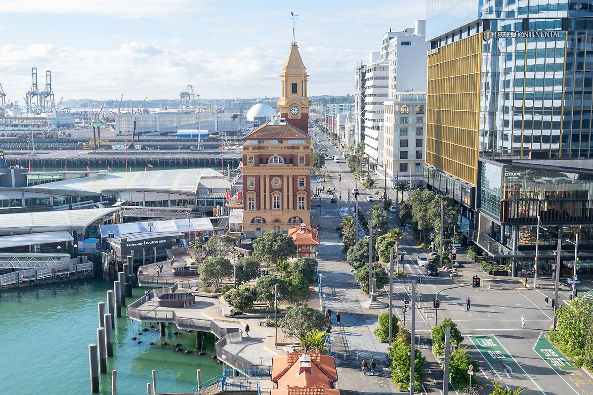
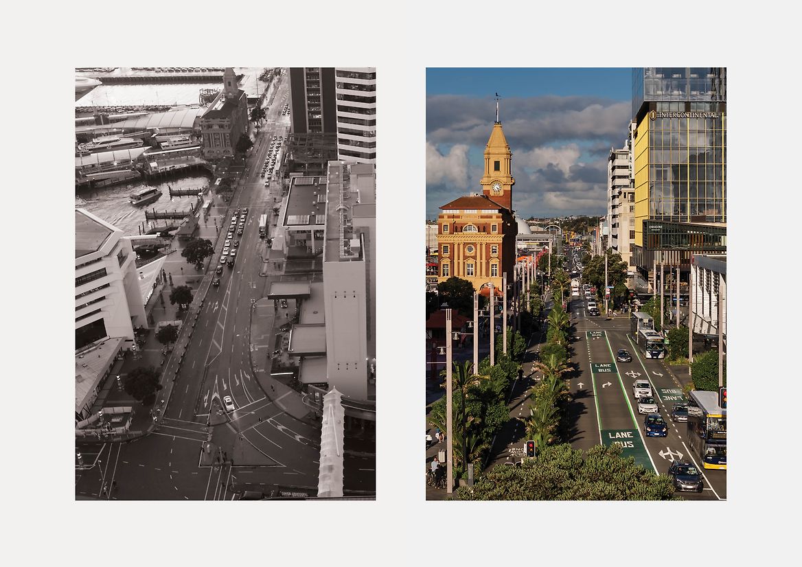
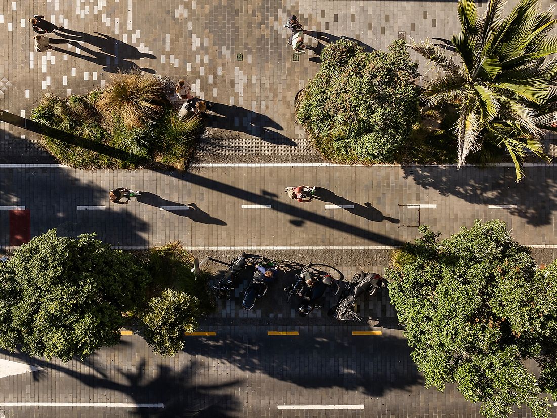
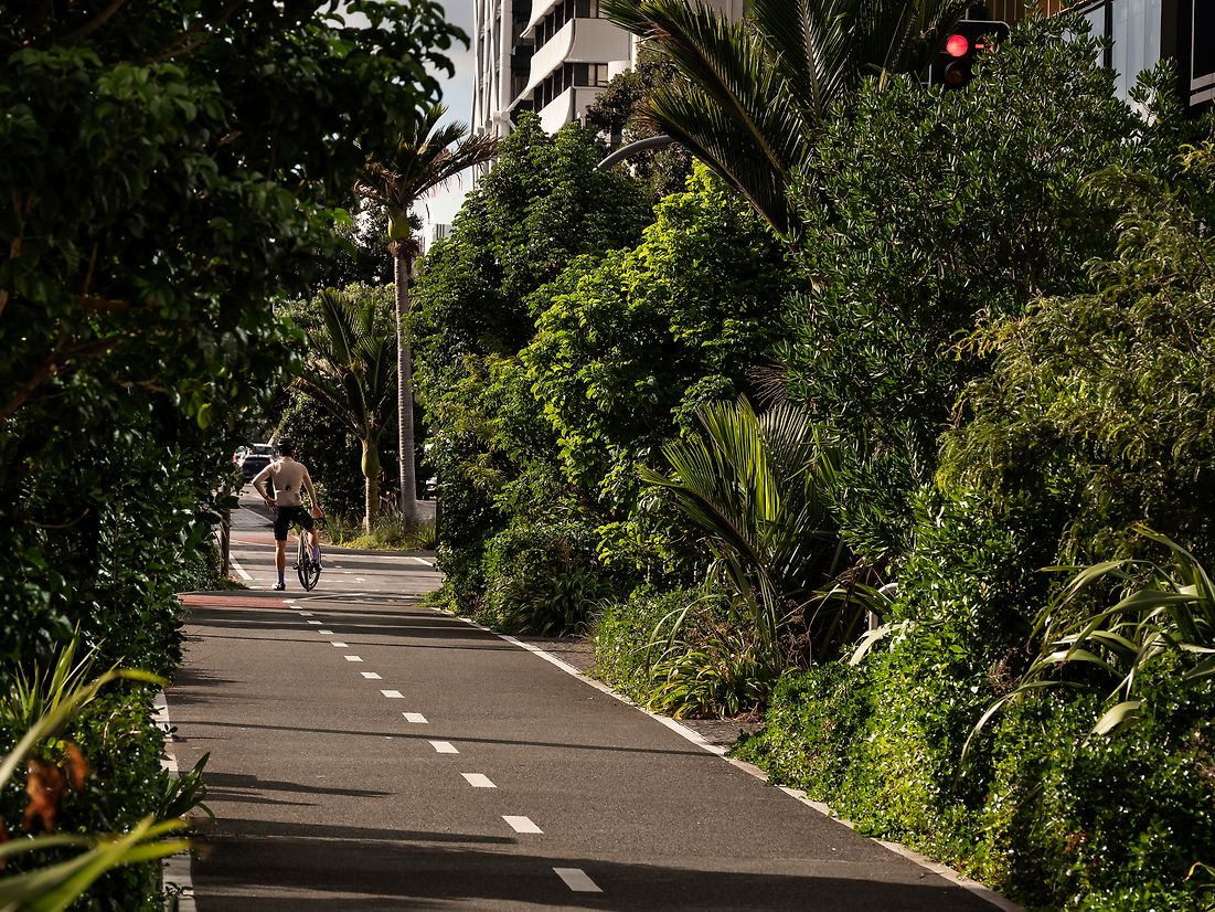
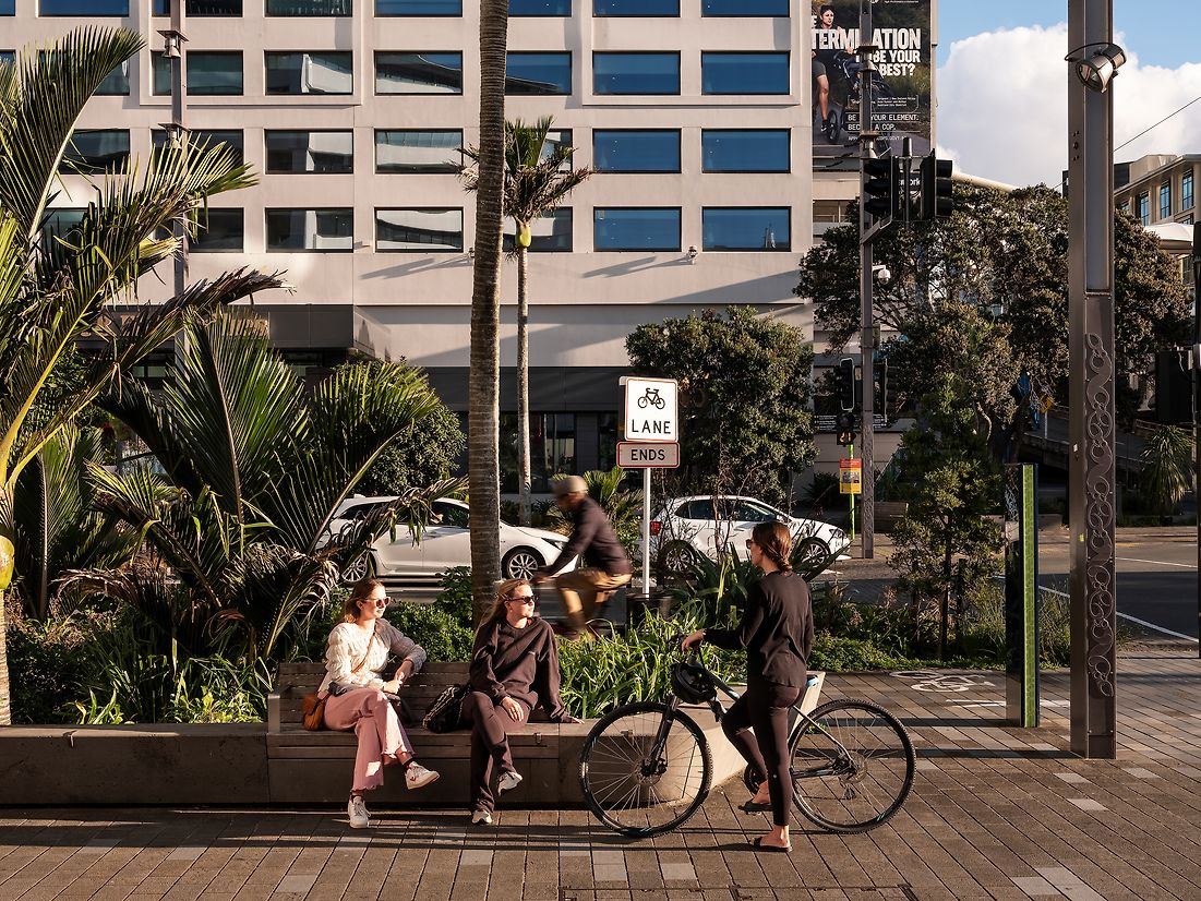
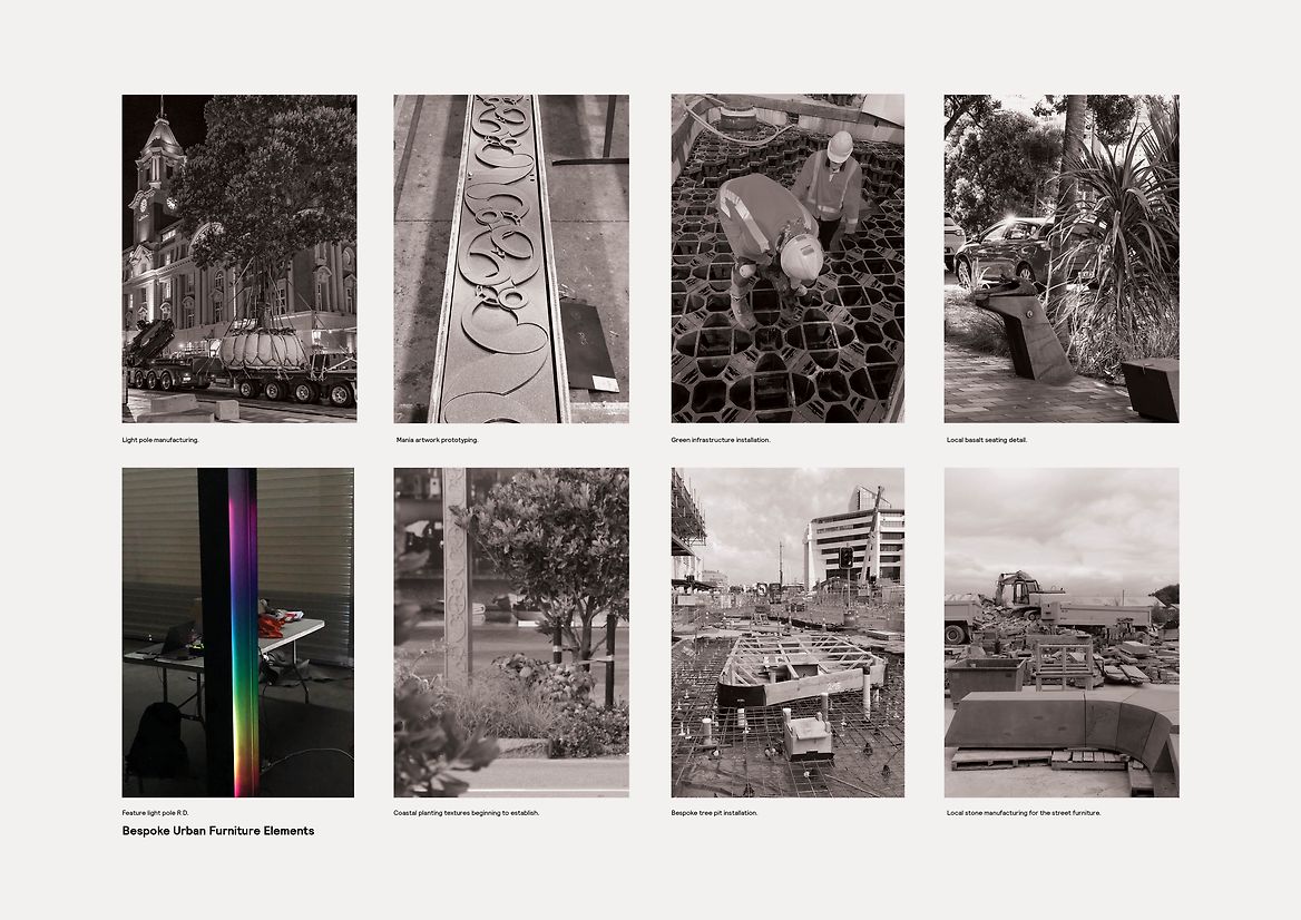
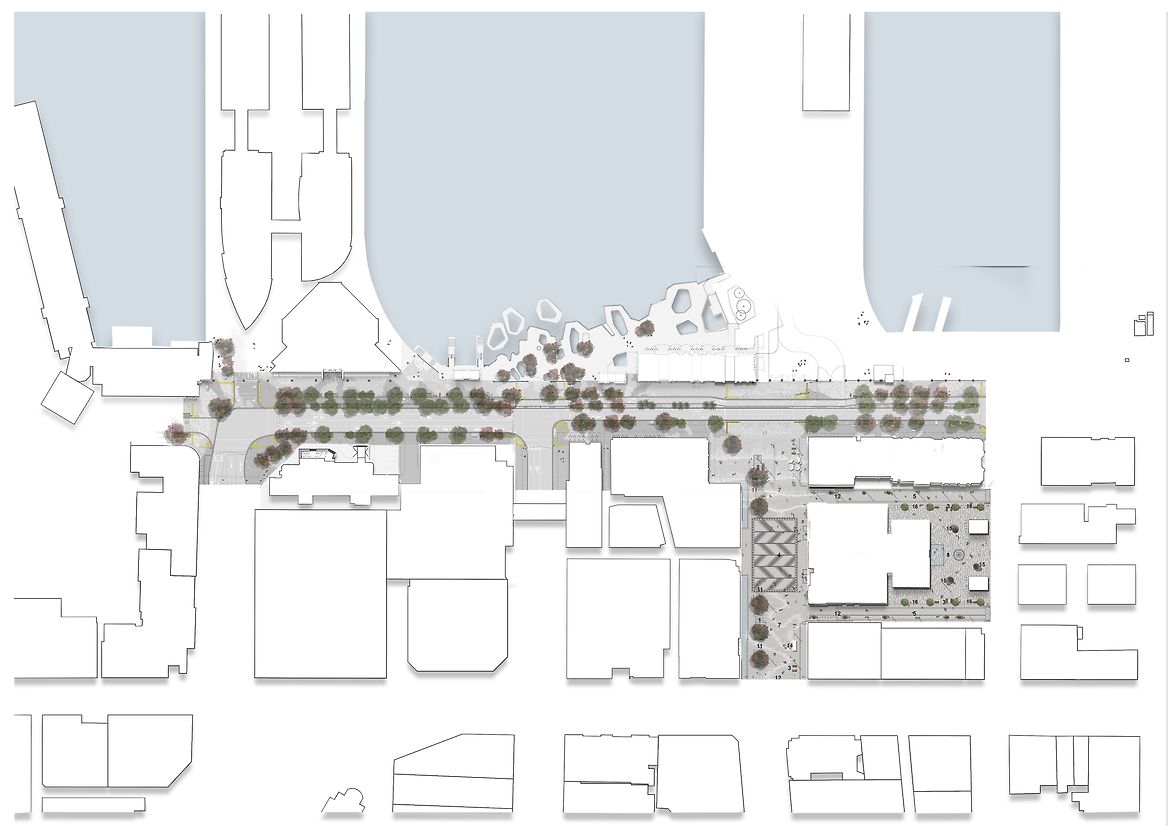
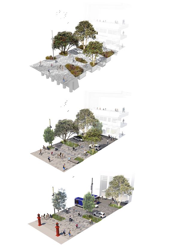
This project represents a complex public realm transformation of an historic downtown waterfront street, which included the transformation of three city blocks from a traffic congested 6x lane through-route – a severing of the city to its waterfront, to a ‘place’ for people and the environment whilst optimising walking & cycling, traffic, servicing and public transport.
The project seeks to create a new, generous and welcoming destination along the City Centre waterfront edge that is recognisably Tāmaki Makaurau in form and function. The aim of the project is to create a people-focused space which strengthen the connection between Te Waitematā and the City Centre’s built form.
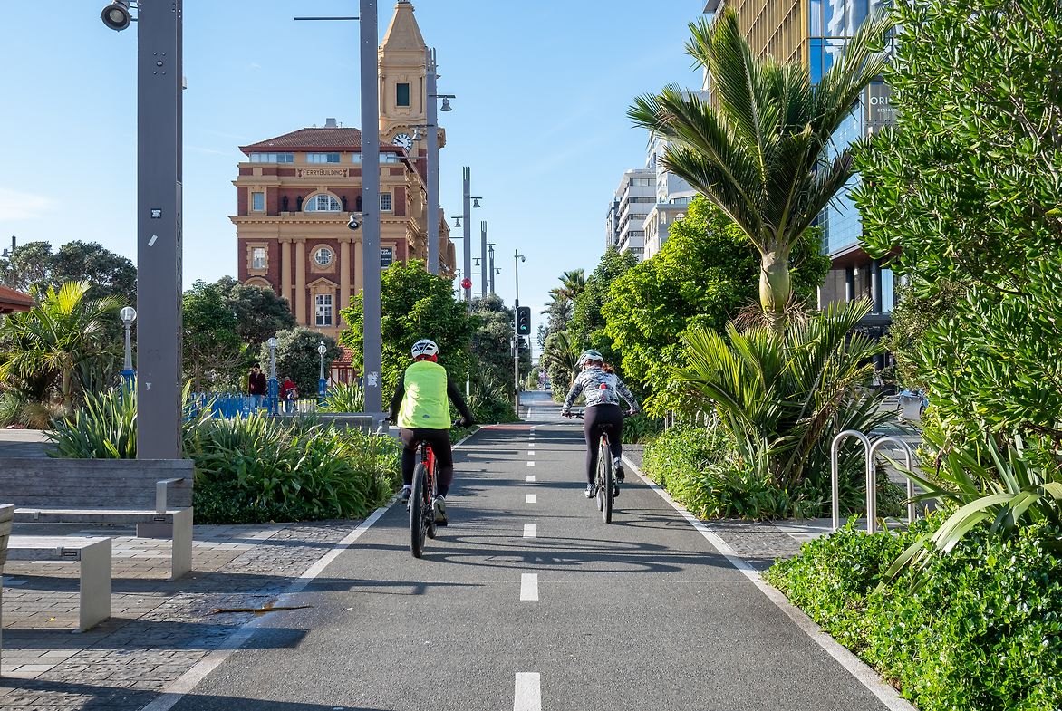
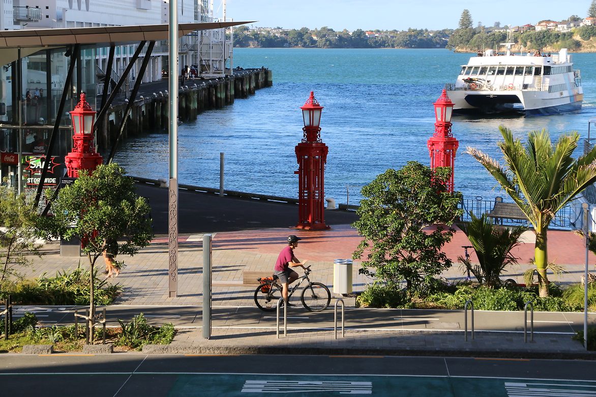
Quay Street (Re)Connects Wynyard Quarter to Tāmaki Drive (east-west) and city to sea (north-south). Showcasing native vegetation. Exceeds ecological/stormwater treatment standards. Demonstrates best practice with site-specific innovation. Reinforcing the Mauri ‘life force’ of the waterfront.
Judge's comments:
A transformational project that has stitched back together the previously severed waterfront-to-city connection. A pedestrian-focused, sustainable strategy has resulted in a well-designed landscape response that will continue to flourish and grow, providing Tāmaki Makaurau with an identity of leafy opulence that will encourage waterfront activation in the heart of the city.