Digital
Locales 26 Ngā Ara Tipuna
-
Pou Auaha / Creative Director
Chris Hay
-
Ringatoi Matua / Design Director
Leigh Bardsley
-
Ngā Kaimahi / Team Members
Lucas Bullmore, Ellen Pullar, Rebekah Lillie -
Kaitautoko / Contributors
Roy Taoho, Nathaniel Leith, Robin Marshall -
Client
Central Hawke's Bay District Council/Te Taiwhenua o Tamatea
Description:
Ngā Ara Tipuna was initiated by mana whenua of the Waipukurau-Takapau rohe, who wished to share their authentic stories of this land and its significance. The project, realised in partnership with Central Hawke’s Bay District Council, needed to cater to the needs of four very different audiences: mana whenua, local residents, education groups, and visitors to the area.
The key objective was to provide a counterpoint to existing Eurocentric histories of Waipukurau-Takapau. This would allow mana whenua to celebrate their stories and pass them on to the younger generation. It would also awaken locals, visitors and education groups to the fascinating histories that are obscured by the contemporary built environment of the towns.
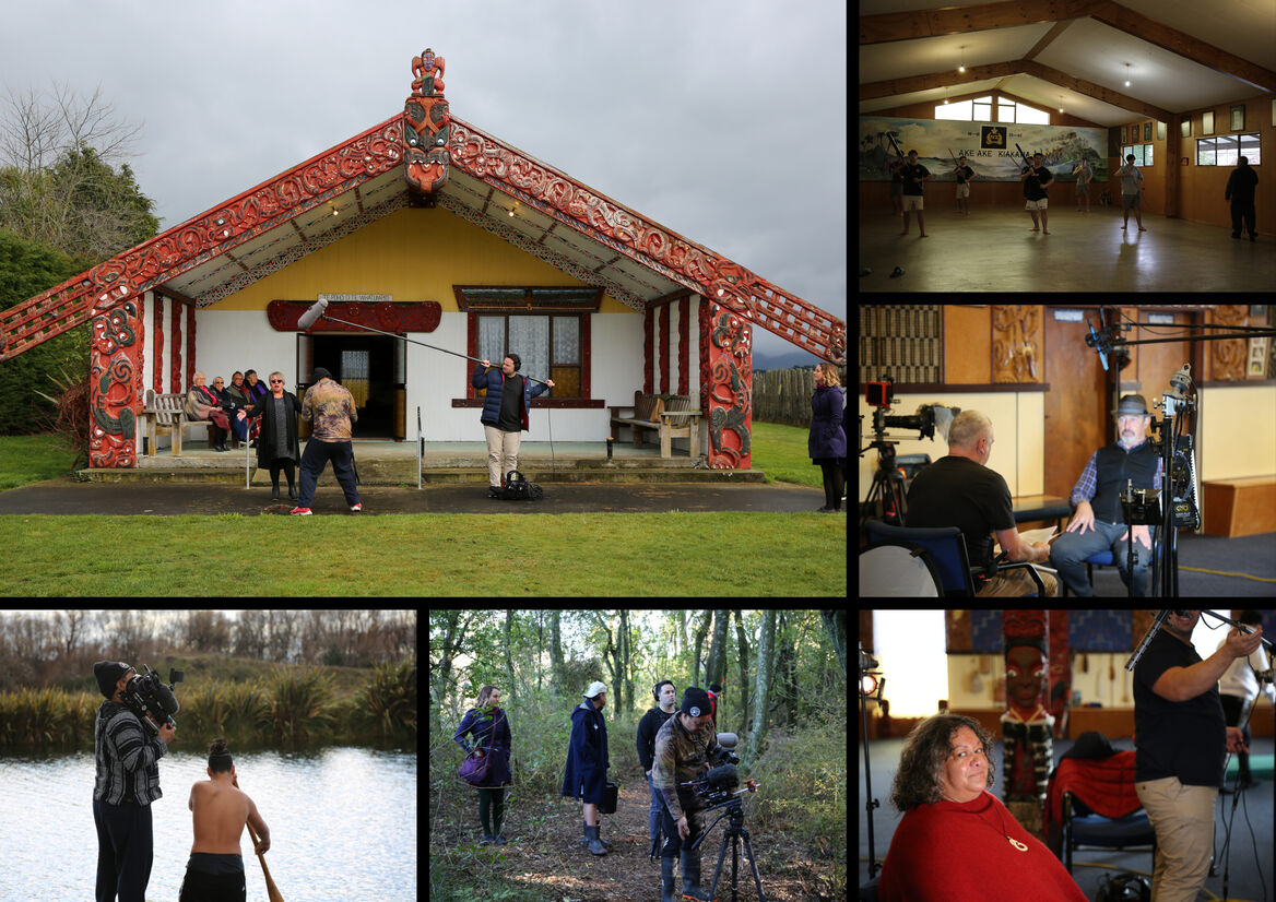
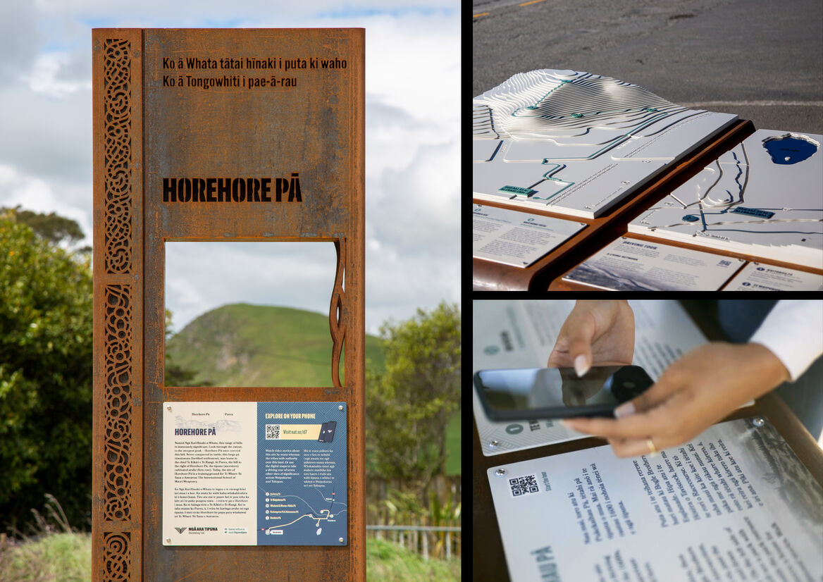
Informed by a series of meetings and focus groups with hapū representatives, residents, teachers, highschool students, and prospective visitors, we devised an interconnected suite of media, designed to cater to the diverse requirements and tastes of our audiences. This included: a mobile phone tour of sites of natural and cultural significance, a website full of resources and interactives for use in the classroom or at home, interpretive signage, sculptural structures, whakairo (carvings) and other artwork.
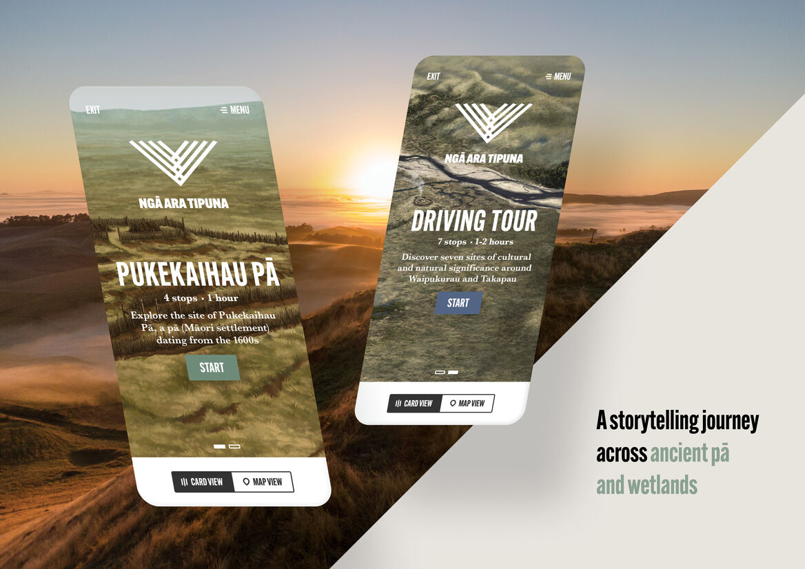
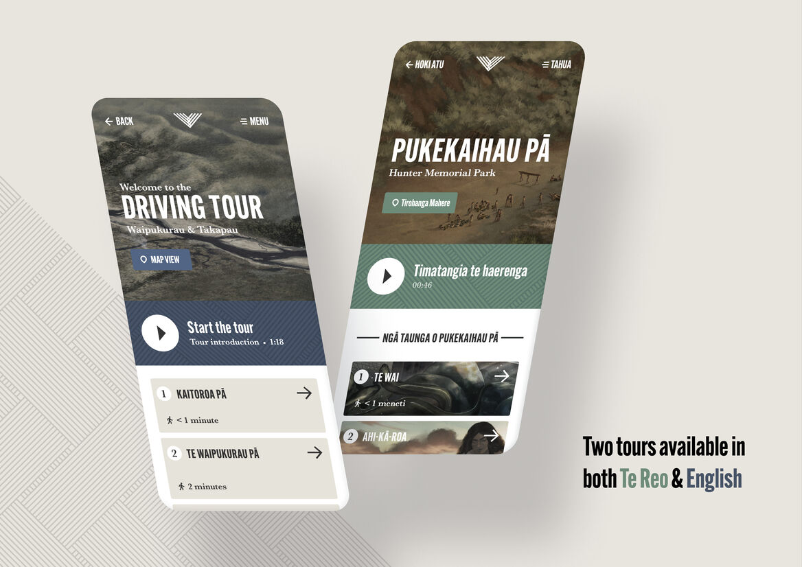
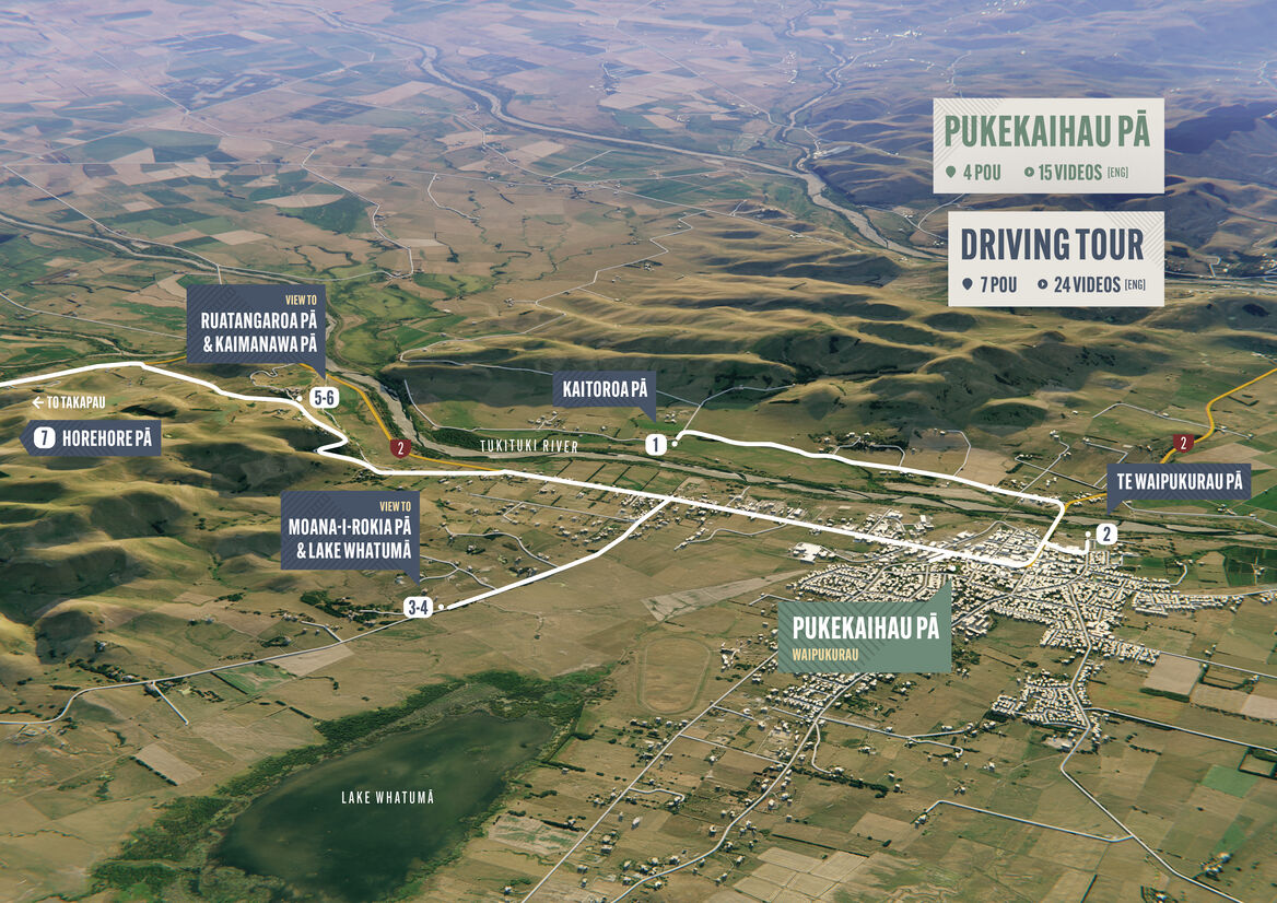
We codesigned Ngā Ara Tipuna with representatives from Rākautātahi Marae, Takapau. They chose to showcase the site of Pukekaihau Pā (now Hunter Memorial Park, in central Waipukurau) and seven other places of cultural importance across the rohe.
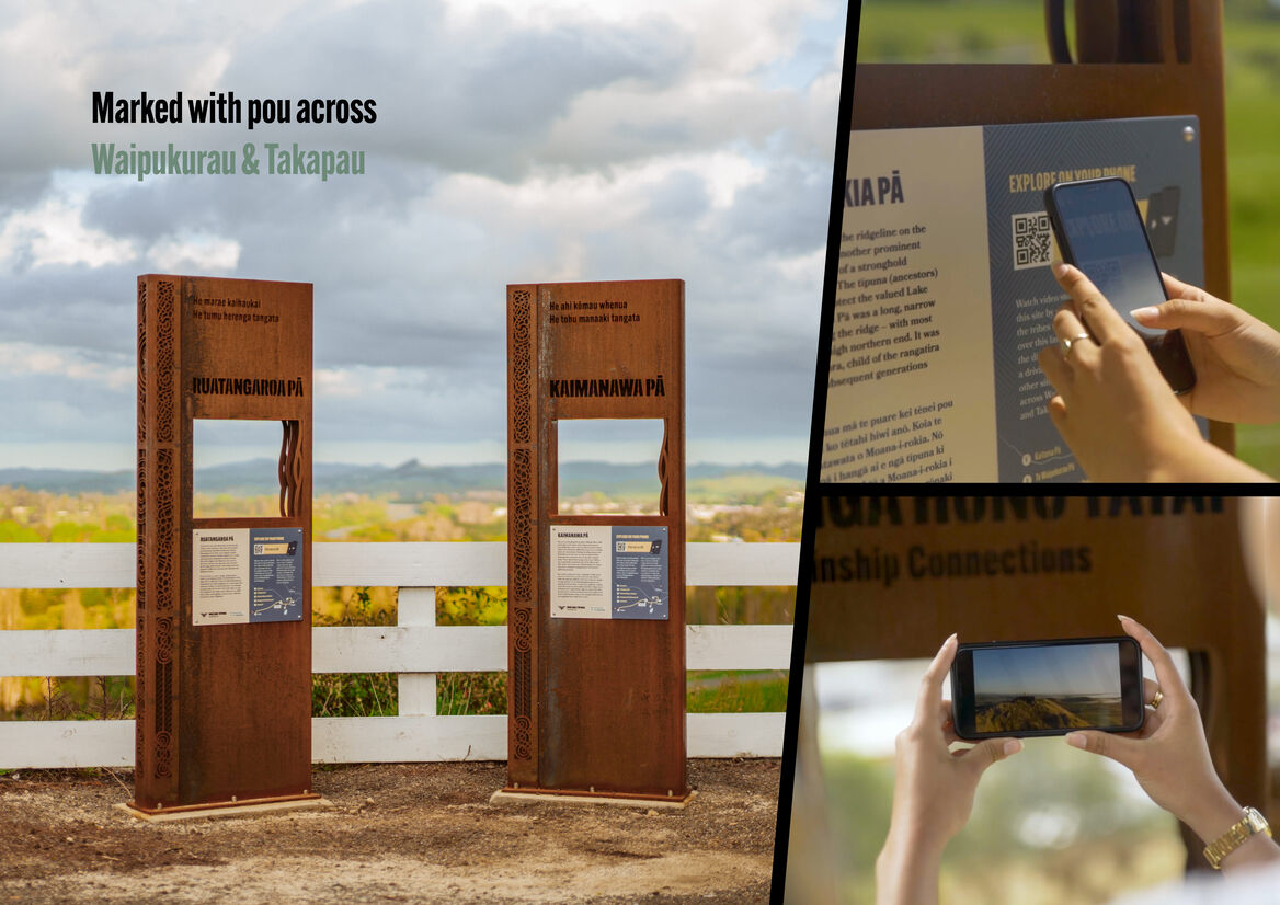
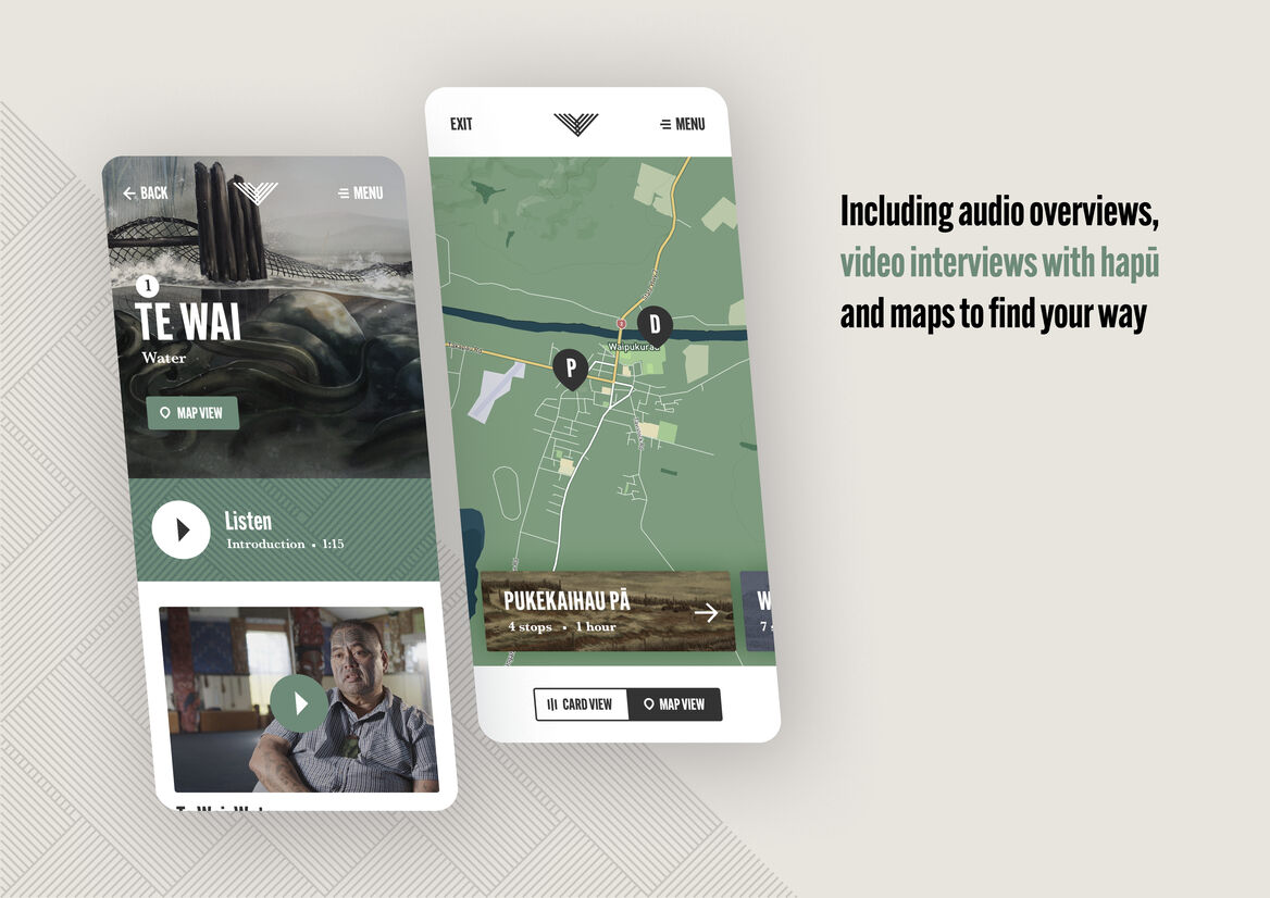
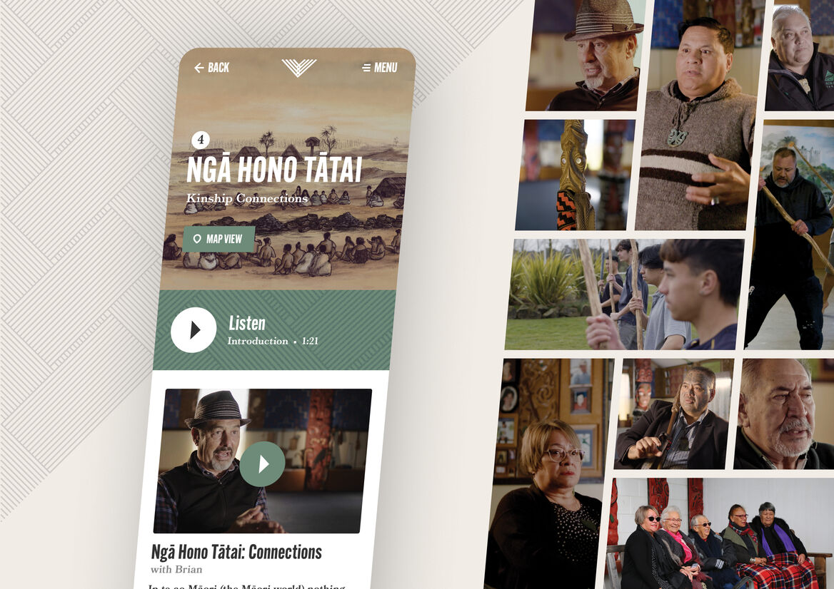
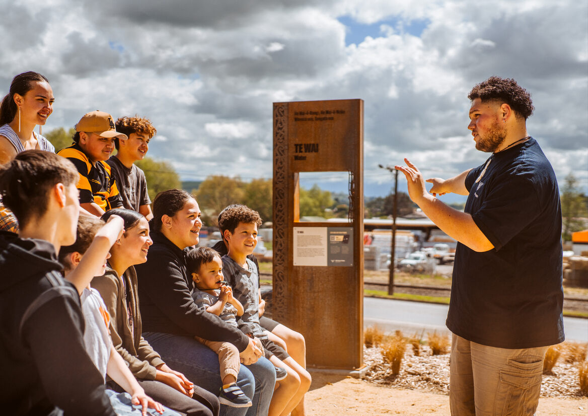
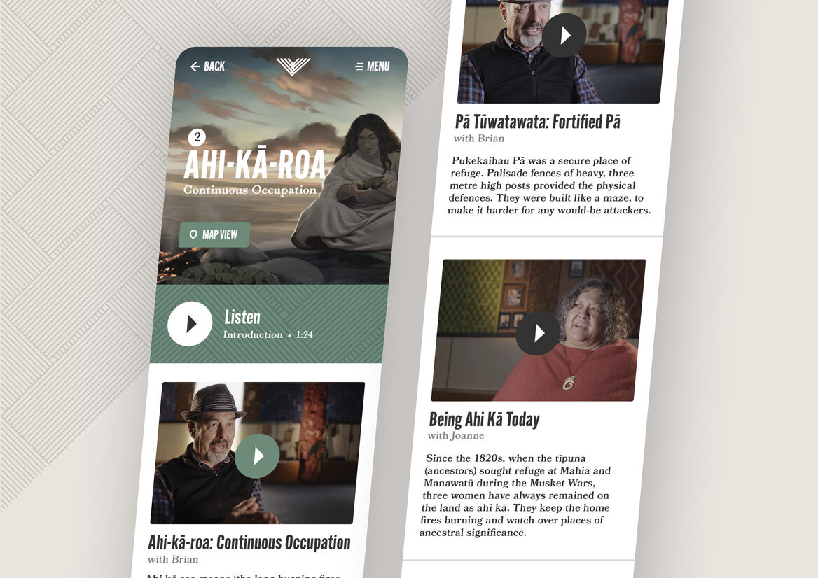
Using their mobile phones, users can take a self-guided tour of these places. Within the mobile tour, maps assist with wayfinding between locations. At each stop users are presented with perspectives from mana whenua on why this place is important. They can engage with the stories in video, audio or text form, depending on their needs and preferences. The mobile tour integrates visually, thematically and technically with signage and other structures on the landscape. Oral history pou at each stop feature QR codes, prompting visitors to use the mobile tour.
Complementary to the concise mobile tour, which is designed to be used while standing on the land, is a website abundant in stories and resources: to be explored from home or the classroom. The website presents timelines of the rohe, from the founding tīpuna to its vibrant present, consisting of a variety of media: videos of the people and the land, mau rākau (Māori weaponry) and waiata performances, audio interviews, illustrations and archival imagery showing how this rohe looked in the past.
The website also features two interactive recreations. Users can explore Pukekaihau Pā circa 1600, engaging with different aspects of the pā – such as the fortifications, food preparation areas, and the spring that flowed from the summit. Alternatively, they can traverse the wider Waipukurau-Takapau area, zooming in on the pā, waterways, forests, and other mahinga kai (food stores/gathering places) that once extended across the rohe. Interpreting a land much changed since the times of the tīpuna was a challenge. To create these interactives, we drew from a range of archival maps and illustrations, contemporary mapping data, and oral histories from mana whenua.